A Polar Vortex Is Heading This Way: Here's What It Means For Weather
While the Old Farmer's Almanac's winter weather forecast called for an overall mild winter across the United States, it did offer the caveat of occasional anomalous events. Though we're not officially yet in winter, one such extreme weather situation is already set to occur. Forecasters are expecting a polar vortex to unleash a stream of incredibly cold air in parts of the Pacific Northwest, Midwest and into western and central Canada over the next couple of weeks. As a result, some of the year's harshest winter weather may happen weeks before the season officially arrives.
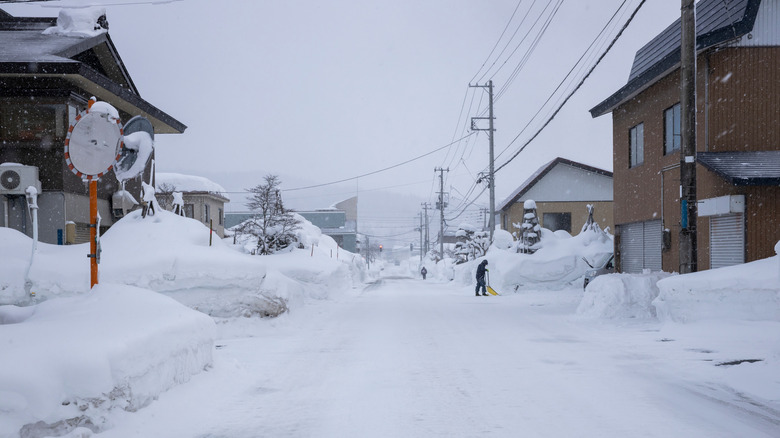
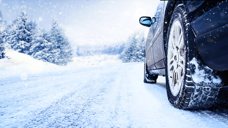
Although such an occurrence in November isn't completely unheard of, it is relatively rare for a polar vortex to have such a dramatic effect so early in the year. In fact, the last time it happened was 1968. It's this potential event that has many forecasters calling for snow for Thanksgiving in parts of the U.S. Of additional concern is the fact this polar vortex is set to begin affecting weather in the Lower 48 just as the holiday travel season ramps up. This might result in flight delays and cancellations, as well as dangerous driving conditions.
Basically, a polar vortex is a rotating mass of cold air that forms over the north and south poles. Typically, this cold air continues to wind in a counter-clockwise, circular manner above the poles. However, at times the vortex can become disrupted and misshapen or enlarged. When this happens (and the European weather model indicates the vortex has already begun to collapse), a blanket of very cold air gets sent south. Prior to Thanksgiving, forecasters are expecting cold air to descend in an inverted triangle in the U.S., with the southernmost point in South Texas and the northern corners in western Washington state and western New York.
Check extended forecasts to stay prepared
The entire area within that inverted triangle (and into Canada) will experience cooler than normal temperatures over the Thanksgiving holidays and perhaps a week or so beyond. This means roughly ⅔rds of the Lower 48 will be impacted. However, the most dramatic weather and temperatures will be contained in a few core areas. That means the most likely affected major cities include Chicago, Dallas, St. Louis, Minneapolis, and Seattle. Parts of the Upper Midwest and the Cascades may see significant snow. This is also roughly follows a La Niña weather pattern, which, incidentally, is in effect this winter, as well.
After Thanksgiving, this polar air will spread beyond these core areas. As it continues to descend and enlarge, a greater portion of the Pacific Northwest and Rocky Mountain regions will become enveloped. Additionally, all of the Northeast and parts of the Mid-Atlantic could feel the effects. At this point, all but the Southeast and parts of the Southwest will likely be experiencing cooler-than-normal temperatures. Because of this, travel difficulties the week following Thanksgiving are expected across a much broader area of the U.S.
Because of the area of potential severe weather is expected to expand over the holiday week and beyond, travelers are advised to use caution. Check the 7-day forecast before you head out, so you are prepared for the weather both to and from your destination. Additionally, whether driving or flying, it is important to be aware of the forecast for areas between your home and holiday destination. This will help you be better prepared for weather related driving conditions or flight delays. Even if you aren't traveling, it's good to know how to prepare for freezing weather.