Low Vs High Pressure Weather: What To Know About How It'll Impact You
We may receive a commission on purchases made from links.
Many people consider the weather forecast the most important part of a local newscast. Watching, you may hear the terms low pressure and high pressure bandied about, but their relevance to the forecast might not be so obvious. In fact, low and high pressure systems directly shape the weather and are associated with fair and foul conditions. Some claim atmospheric pressure has an effect on their health. Fishermen even say it impacts whether fish will bite. Knowing the difference between low and high pressure weather, and how it is measured, will help you understand how it might impact you.
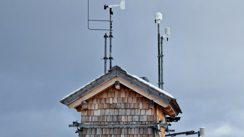
Long before detailed satellite- and weather balloon-based forecasts were available on apps, farmers, sailors, and other predicted the weather using barometers. Essentially, a barometer is a gauge measuring atmospheric — also known as barometric — pressure. A barometer is still an essential tool for meteorologists and weather forecasters. It literally measures the weight of the atmosphere in a given area and the pressure that exerts. To help the non-meteorologist, a cheat system of sorts is often written along the length of a barometer, indicating weather types associated with various pressure points, such as "fair," "stormy," and so on.
In addition to knowing the pressure levels — expressed in either atmospheres (atm) or millibars (mb) — it is important to note the rate and direction of change. The average pressure at sea level is 1013 mb, so above that number is high and below it is low. The direction of change indicates the type of weather on the horizon, while the rate of change (slow, moderate, or rapid) helps specify the intensity. This is true whether reading an analog barometer or a digital model such as the Ambient Weather station.
Low pressure indicates unstable weather
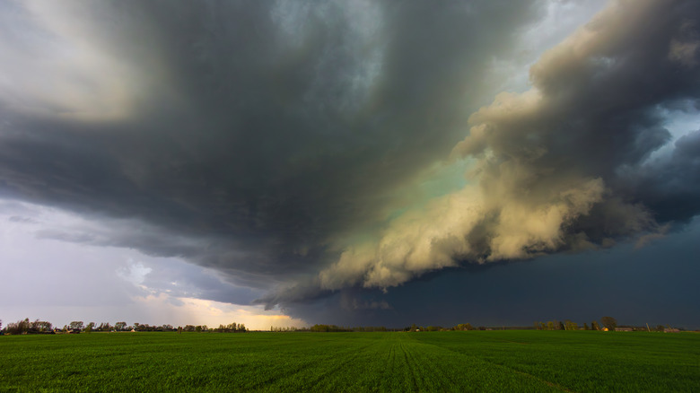
As a rule, low pressure means bad, or at least unstable, weather. This happens because an area of low pressure allows warm air to rise. That warm air then cools higher in the atmosphere, resulting overcast skies, rain, snow, sleet, high winds, and freezing rain. During periods of low pressure, it is also common to see colorful skies, beyond just grey. This is what led to the old saying, "red skies in morning, sailor's take warning." It's also why the sky turning green will have you preparing, as a severe storm system is approaching.
There are, of course, different levels of low. To that end, the lower the pressure, the more unstable the weather and the closer you are to the center of a storm system, as that is where the lowest pressure is recorded. The rate of change will also indicate how drastic the weather could be. Over a three-hour period, a change of 1-2 millibars means slow change, 2-3 mbs indicates moderate, and 4 or more means severe weather is on the way. Additionally, since low pressure systems move in a counterclockwise direction in the northern hemisphere, they are associated with cyclonic storms. Nor'easters during the winter and hurricanes in the summer and fall are two examples of cyclonic storms resulting from low atmospheric pressure.
When it comes to your body, low pressure is also associated with issues such as joint pain, because the dropping pressure causes tendons, ligaments, and tissues to expand or become inflamed. Some suggest that the foul weather resulting from low pressure systems also darkens moods. Low pressure may trigger headaches, though these can also be caused by high pressure or pressure changes in either direction.
High pressure means sunny days are on the way

By contrast, high pressure is often associated with good, or at least stable, weather conditions. High pressure means air is moving down, toward the ground. This prevents the rise of cloud-forming water vapor and other elements. As a result, clear skies with few or no clouds are the norm when high pressure settles in, regardless of the season. Humidity levels are also lower during high pressure periods. This combination is what gives us those crisp, clear days following a cold front, as well as bright, sunny beach days during summer.
Although high pressure weather is stable, it can still be extreme, particularly in regards to temperature. Due to the lack of cloud cover, the sun's rays bear down with full force during the daylight hours. These same clear skies allow heat to rapidly escape at night. So, sunny days heat up fast while clear winter nights quickly become frigid. High pressure is also behind some of the extreme temperature events experienced in the U.S., such as heat domes and arctic cold fronts. It is important to note that while there is often stormy weather associated with fronts, it occurs along the frontal boundary, where the high pressure and low pressure masses collide. Behind that line is the stable, high pressure area, which is why the days following the passing of a front typically offer good weather. Counterintuitively perhaps, high pressure systems can also cause dense fog and smoggy inversions. When the winds associated with low pressure systems are absent, nothing is blowing moisture and pollution clear.
As already mentioned, some connect high pressure to increased headaches. Additionally, blood pressure levels are reported to vary along with barometric pressure changes. On the recreational side, fishermen have also long claimed high barometric pressure make fish less active and harder to catch.